
![]()
![]()
![]()
![]()
![]()
|
|
|
website under construction |
Saturday, June 23, 2001
 Despite the fact we arrived at the Golden Eagle Ranch
RV Park campground in the middle of the night, we had to get up bright and early to
make it to the Manitou and Pike's
Peak Cog Railway, where we had reservations at 8:50 AM that morning. We still had to
get used to the routine of managing the hook-ups of an RV, putting away the bedding,
getting the people through a shower and stuff like that. Also checking out took a bit
longer than expected.
Despite the fact we arrived at the Golden Eagle Ranch
RV Park campground in the middle of the night, we had to get up bright and early to
make it to the Manitou and Pike's
Peak Cog Railway, where we had reservations at 8:50 AM that morning. We still had to
get used to the routine of managing the hook-ups of an RV, putting away the bedding,
getting the people through a shower and stuff like that. Also checking out took a bit
longer than expected.
 As a result we were running late. We got pretty good directions during
check-out, but since the road signs were not very clear, we still managed to drive wrong
twice. The first time was not a big deal, because it was only a city block, but the second
time put us in the whole wrong part of Manitou Springs. By then it was after 8:50 and we
figured we wouldn't make it, despite the fact that the train wouldn't leave till 9:20.
As a result we were running late. We got pretty good directions during
check-out, but since the road signs were not very clear, we still managed to drive wrong
twice. The first time was not a big deal, because it was only a city block, but the second
time put us in the whole wrong part of Manitou Springs. By then it was after 8:50 and we
figured we wouldn't make it, despite the fact that the train wouldn't leave till 9:20.
 We turned
the RV around and gave it a try after all. We drove back to the highway and finally
arrived in the small town with small streets, partly only allowing traffic in one
direction. When the railway came in the picture, a helpful traffic guide helped Rob to
back into an RV parking lot on a hill close to the station.
We turned
the RV around and gave it a try after all. We drove back to the highway and finally
arrived in the small town with small streets, partly only allowing traffic in one
direction. When the railway came in the picture, a helpful traffic guide helped Rob to
back into an RV parking lot on a hill close to the station.
Grandma and Grandpa were on 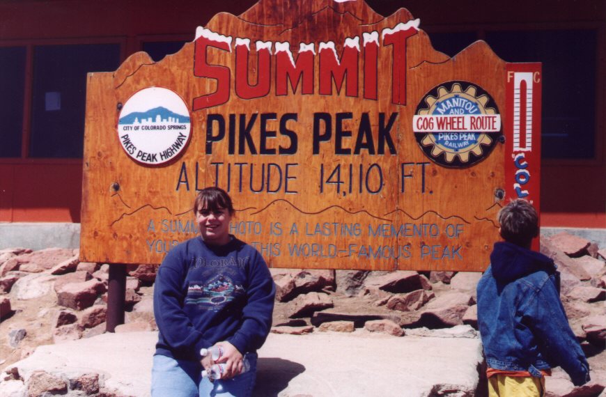 Pike's Peak before and didn't want to go this time,
because of the altitude. Since Jarrett joined our trip in the last moment, we didn't have
reservations for the kid and it was not possible to make reservations that close to the
travel date. Rob got in line for the tickets and got all five reserved spots next to each
other in the train and even got permission for Jarrett to go with us, as long he would be
in our laps, not taking up a seat.
Pike's Peak before and didn't want to go this time,
because of the altitude. Since Jarrett joined our trip in the last moment, we didn't have
reservations for the kid and it was not possible to make reservations that close to the
travel date. Rob got in line for the tickets and got all five reserved spots next to each
other in the train and even got permission for Jarrett to go with us, as long he would be
in our laps, not taking up a seat.
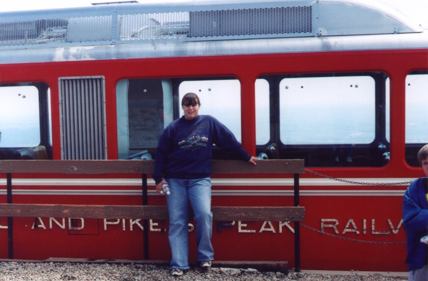
![]() The Cog Railway is invented in Switzerland and the equipment
they used was from there as well. The train runs on rails with a third double one in the
middle that looks like a zipper. A series of special wheels in the middle of the train
pulls you up. This is the highest cog railway in the world. The view from the train was
very nice. Sometimes you could look back to Manitou Springs and Colorado Springs behind
the train. Jessie, the conductor, told about the special views and some of the history of
the railway and the mountain.
The Cog Railway is invented in Switzerland and the equipment
they used was from there as well. The train runs on rails with a third double one in the
middle that looks like a zipper. A series of special wheels in the middle of the train
pulls you up. This is the highest cog railway in the world. The view from the train was
very nice. Sometimes you could look back to Manitou Springs and Colorado Springs behind
the train. Jessie, the conductor, told about the special views and some of the history of
the railway and the mountain.
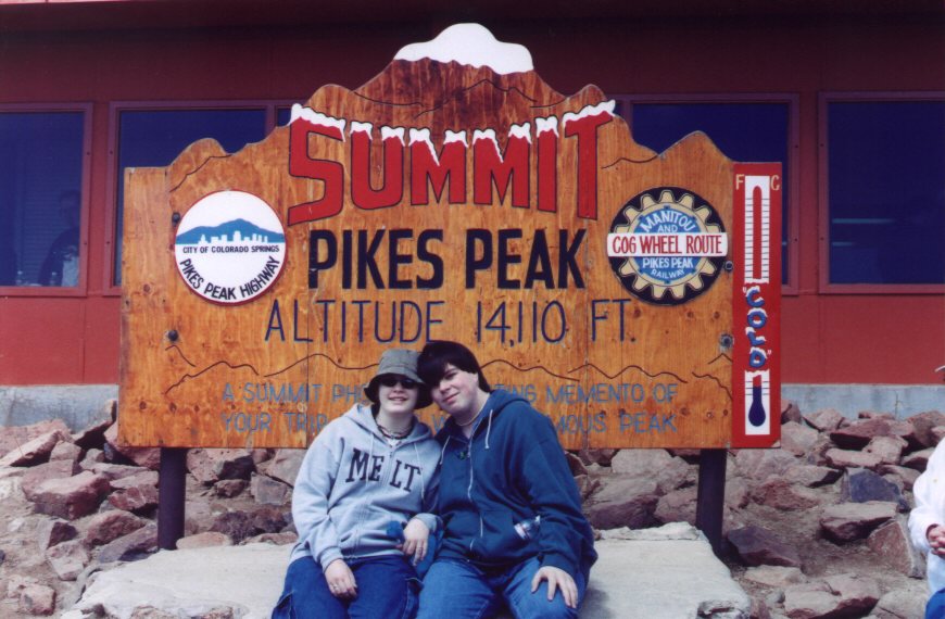
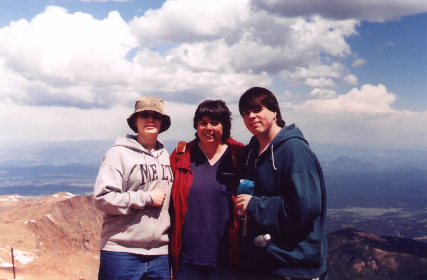 On our way to the top, it showed that we were low-land people, because we
all got impacted by the altitude at a certain point in the trip up or at the top of Pike's
Peak, which is 14,110 feet (4300 meters) high. The symptoms ranged from dizziness to an
unstable feeling or from a general feeling of not being there to feeling trembles in the
ground that were not actually there. At the top we bought some water and food to fight the
altitude sickness.
On our way to the top, it showed that we were low-land people, because we
all got impacted by the altitude at a certain point in the trip up or at the top of Pike's
Peak, which is 14,110 feet (4300 meters) high. The symptoms ranged from dizziness to an
unstable feeling or from a general feeling of not being there to feeling trembles in the
ground that were not actually there. At the top we bought some water and food to fight the
altitude sickness.
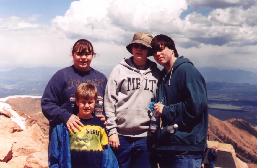
On top of the mountain, a good way above the timber line, there was still some snow left. The snow here is not as much as the snow in the Alps, despite the fact that the mountains are higher. This is caused by the fact that these mountains are located more to the South than the Alps and the amount of precipitation is probably lower as well. Also, there were several cars on the top, as a road is going all the way up. It takes a long time to drive up, but it can be done. Every year around Independence Day there is a race for specialty cars and the one for this year just had taken place when we went up and several of these oldtimers were still at the top of the mountain.
We could stay at the top for about half an hour and then had to board the train again to go down. Everybody had to take their same assigned seats as on the way up, so the views were pretty much the same, although we shuffled our row, so the people on the left could see what they missed on the right and the other way around. The conductor had a question and answer session while she went through the train selling booklets and videos.
Grandpa and Grandma did d some grocery shopping while the rest of the bunch was on the mountain. This was an adventure in itself, because it was hard to find a place to park the big RV close enough to a store. They finally were directed to a Walmart that had enough space. They bought some fresh fruit and other things we needed and when the rest arrived down, they were back in the parking spot where they left of.
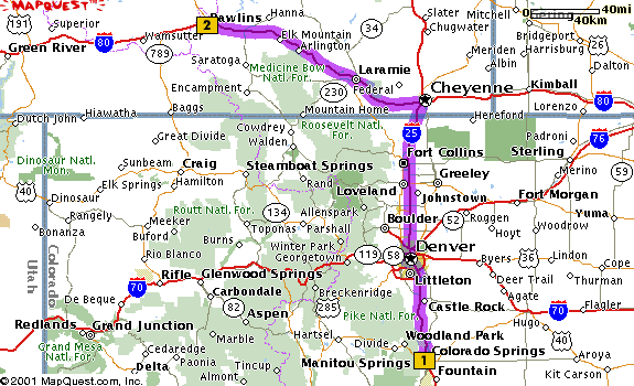
While we were leaving Manitou Springs for the second big stretch of our trip, lunch was made in the kitchen of the RV. Pretty soon we hit Interstate 25 North towards Denver and the Wyoming border. The majestic Rocky Mountains we visible on the left side of the car. Rob started out driving and Grandpa took over at a gas station just after Denver. Despite the fact that everybody thought it would be cooler in Colorado, the gas station's thermometer showed 110 degrees Fahrenheit. It was probably not really that high, but it still felt incredibly hot. We had to get some money at an ATM there as well, as the Pike's Peak Railway took our last cash.
Around the border between Colorado and Wyoming, the mountain features seemed to disappear a bit. The peaks seemed to be lower and flatter. The reality is that we were getting higher and that we entered a high plains area. We went by Cheyenne and through Laramie. The Medicine Bow National Forest is located on both sides of the road, but cannot be seen from Interstate 80, the road we were on.
After Laramie, the weather took a turn and the wind became very powerful. Dust, sand
and eventually rain blew across the road and the environment looked quite a bit like the
scenes you see in a documentary of expeditions in Arctic areas. There were a couple of
places where road work did reduce the lanes and oncoming traffic was driving in what
normally would have been the left lane. Passing trucks made the wind gusts so powerful
that Rob had a bruise in the palm of his left hand in the place where the steering wheel
hit.
Just before Rawlins, the weather cleared up and we decided to get us some dinner in a restaurant instead of making the dinner in the kitchen of the RV. We finally decided on the J&B restaurant across the street from the Western Hills Campground we arrived at around 6 or 7 PM.
|