
![]()
![]()
![]()
![]()
![]()
|
|
| ||||||||||||||||||||
website under construction |
Sunday, June 24, 2001
We left the Western
Hills Campground in Rawlins pretty much in time. We did take a bit different route
than originally planned, which showed to be a good choice later in the day. The first part of our trip today was pretty rough. It was going almost
straight from East to West on Interstate 80 through the total nothingness of Wyoming
and it was very windy and during the stretch from Rawlings to Rock Springs we used
more than half a tank of gas.
The first part of our trip today was pretty rough. It was going almost
straight from East to West on Interstate 80 through the total nothingness of Wyoming
and it was very windy and during the stretch from Rawlings to Rock Springs we used
more than half a tank of gas.
Although the elevation in this area is considerable (around 8000 feet above sea level), everything seems to be pretty flat and the amount of mountain views is pretty limited. There was so little vegitation that it seemed as if we were above the timber line, but that showed not to be true when we saw trees above our level on the one-and-only 'real' mountain in the area.
It was the first time we crossed the Continental Divide, a line on the map of the USA that indicates the water separation - water on the east of the line flows to the Atlantic Ocean and water on the west of it flows to the Pacific Ocean. We crossed it at a little bit special location, because the Divide was surrounding the Great Divide Basin, from which apparently no water gets to any ocean.
Close to Rock Springs, the scenery changed. Some steep rock mountain cliffs were right next to the road, just before we had to turn north. After the turn, on the westside of the road, 191, we saw some interesting mountains that showed layers of different colors. The most significant layer, somewhere in the middle was white, while the rest showed various shades of red. After a few miles the road curved into those mountains and we ended up at a plateau that was empty. there was some growth of stubby vegetation, but basically we were back in the nothingness of Wyoming. We saw a dust devil, a weak whirlwind that sucks dust in the air, and some deer, but that was about all the excitement for miles and miles.
After a while we could see a ridge of snow capped mountains on the east side. The more
north we came, the closer the ridge was to the road.  Much further
north, also on the westside of the road a ridge of snow capped mountains appeared. The
general feeling of emptyness started to change around the time we reached the town of
Pinedale. This town was still in the old western style and with a little imagination, you
could still see the horses standing in the sand in front of the local saloon.
Much further
north, also on the westside of the road a ridge of snow capped mountains appeared. The
general feeling of emptyness started to change around the time we reached the town of
Pinedale. This town was still in the old western style and with a little imagination, you
could still see the horses standing in the sand in front of the local saloon.
Both ridges eventually would come together in the Tetons. Just before we reached these
mountains, though, the landscape changed dramatically.  All of a sudden mountains with pinetrees lined the road, which was now
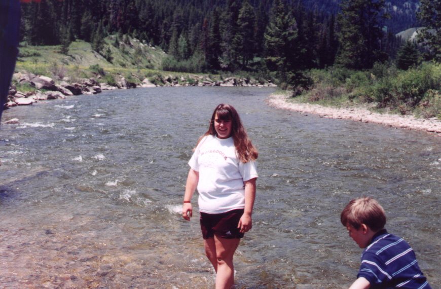
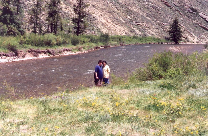
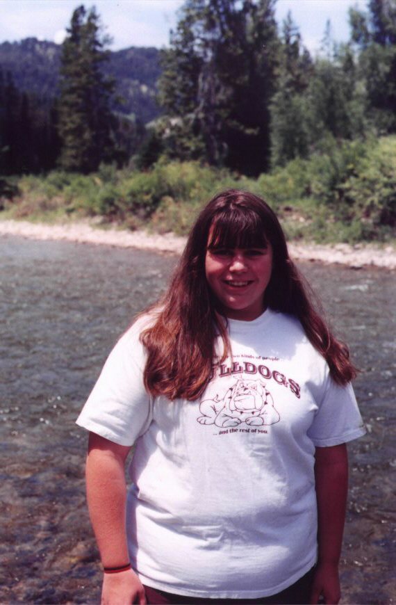
along the Hoback River. At a scenic point, we stopped the RV to make some pictures.
Jennifer really liked this location
All of a sudden mountains with pinetrees lined the road, which was now
along the Hoback River. At a scenic point, we stopped the RV to make some pictures.
Jennifer really liked this location
The kids came out and waded in the river. Steve went in on his flip-flops, but the current got a hold on one of them and Steve ended up chaising it, resulting in a big splash, when he dove after his flip-flop. He got it, but he was also sitting in the river and therefore he was soaked. No big damage, except that his wallet and its contents had to be dried.
 |
 |
|
 |
||
 |
||
 |
 |
|
 |
||
 |
 |
 |
 |
|
 |
 |
After our stop at the Hoback River we came through Jackson, a reasonably big town, just
South of Grand Teton National Park. In the center of town they have a little plaza with a
gate made of stacked antlers, that were found by Boy Scouts over the years.  After
Jackson, the road was lead around the National Park for a big part, which gave great
overview vistas of Grand Teton, Mount Moran and the rest of the mountain ridge with wide
fields and lakes in front of it.
After
Jackson, the road was lead around the National Park for a big part, which gave great
overview vistas of Grand Teton, Mount Moran and the rest of the mountain ridge with wide
fields and lakes in front of it.
Eventually, after turning left at Moran Junction, we ended up in front of the gate and Grandpa could let us all in for free with his National Parks pass. We drove by the Colter Bay area, where we would stay a couple of days later, and Jackson Lake. It was not totally clear where exactly we left the Grand Teton National Park, because there was no gate on the North side, but after about 10 miles we passed the Yellowstone National Park sign and the gate at the South Entrance of the park.
|